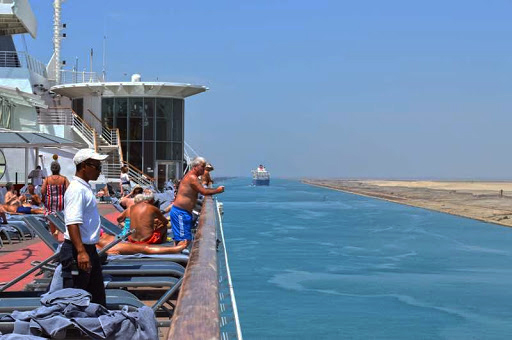
Suez Transit 2015
- Escapedatlast.com

- Sep 24, 2020
- 1 min read
In a continuation of the posting of experiences i had back in 2015. Now available due to the discovery of media files i thought were long lost. Here is a short post chronicling my Suez Canal transit back in 2015.
Do not forget to view the accompanying video in the sites Video Library.

The Suez canal, is a sea-level waterway running north-south across the Isthmus of Suez in Egypt, connecting the Mediterranean to the Red sea.The canal separates the African continent from Asia, and it provides the shortest maritime route between Europe and the lands lying around the Indian and western Pacific oceans.
The canal extends 120 miles between Port Said in the north and Suez in the south. The canal is one of the world’s most heavily used shipping lanes along with the Panama canal, which i have also had the luck to have visited.
The Suez Canal is an open cut, without locks, and, though extensive straight lengths occur, there are eight major bends.To the west of the canal is the low-lying delta of the Nile River, and to the east is the higher, rugged, and arid Sinai Peninsula.
The journey through the canal, north to south, takes approximately ten hours and may be undertaken early morning or late at night, depending on traffic flow requirements. Our journey started at 4 A.M at Port Said, so one of the benefits of a daytime transit, is that it provides a great view of the The Mubarak Peace Bridge.


Comments